Clark Canyon: A Water-blessed Canyon

June 1st: CNPS hosts a botanizing tour of the northern Bodie Hills.
June 27, 2018
SNARL Lecture: Sage Grouse in Long Valley and Bodie
July 9, 2018
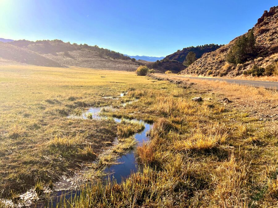
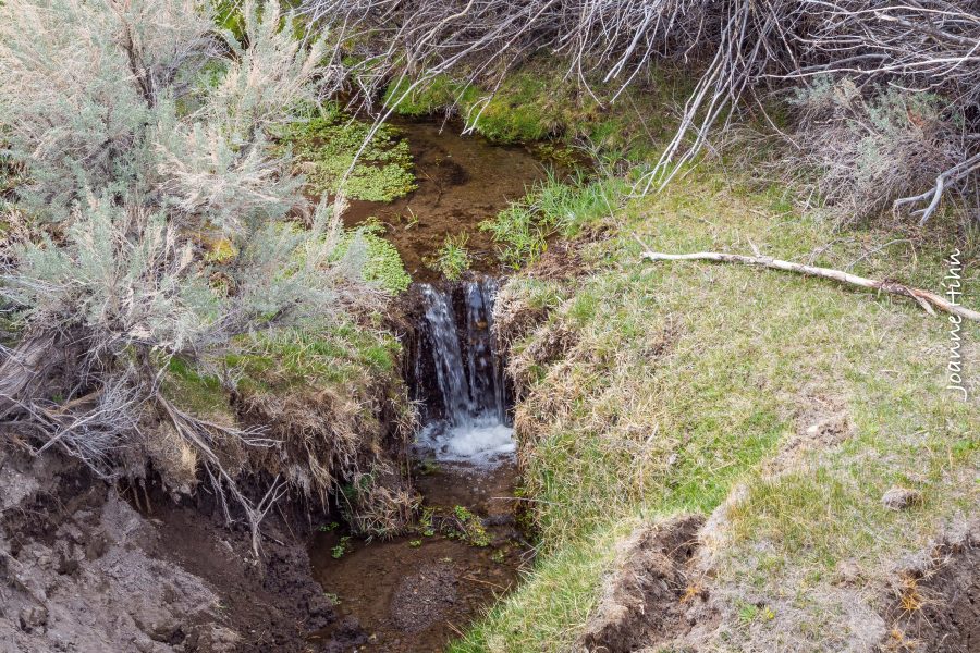
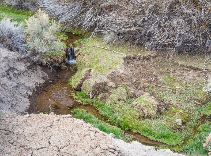
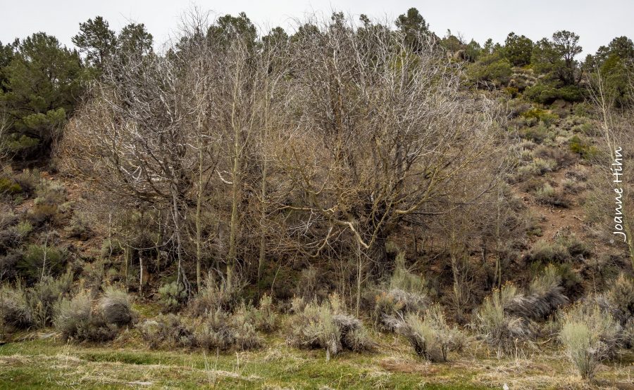
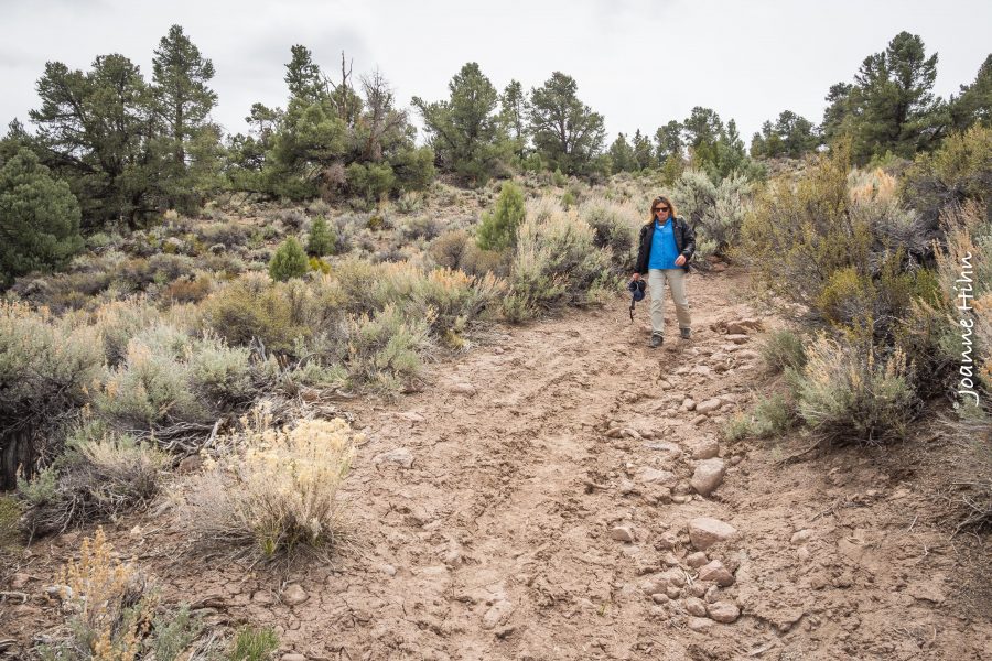
We had a fabulous time on our Clark Canyon Hike on May 12th 2018! After driving up Aurora Canyon Road we parked and walked up Clark Canyon along the flowing stream. Our group enjoyed amazing views as we began a gentle uphill walk with blooming Iris’s and monkeyflower, beautiful robust sage and plenty of birds. Pinion Jays made their presence known, calling from the canyon “walls” as Violet-green swallows zipped around above us. Enjoy reading our co-leaders’ (Lynn Boulton of the Sierra Club Range of Light Group) report below. We hope to see you all on the next outing.
Clark Canyon Hike


Hike Description:
Follow the stream up Clark Canyon on a cattle trail through Pinyon-Juniper sagebrush terrain up to a lush grassy meadow. Canyon Wrens will sing to you as you pass through the narrower volcanic bluffs. Golden and wax currants and wild roses line the trail mixed in with the Sagebrush, Bitterbrush and Rabbitbrush. As the canyon opens up and you reach a wide gully on your right, the ruins of a Chinese camp are just a few yards ahead. There are shards of Chinese pottery, tin cans and partial walls of three buildings. Please leave the artifacts where they are. It is illegal to remove them and it is much more interesting to see them in this context. The turnaround point is the lush meadow just up ahead where the solar panel is. You are on private property from Chinese Camp to the meadow.
To do the loop, continue across the meadow heading south to the fence. Follow the fence to the right a few yards and enter the gate. Please close the gate behind you. Follow the dirt path/old road until you come to a “Y”. Go straight ahead up the hill. When you see houses and a water tank, this road will end at another road. Turn right and then a quick left heading toward the houses. You will pass a fence. When you come to the next road, go left. This is the road to your car.
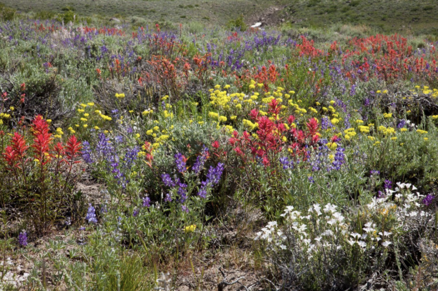
Wildflowers on the trail:
Iris, California Hesperochiron, Starry False Salomon Seal, Drummond’s Cinquefoil, Woollypod Milvetch, Bodie Hills Cusickiella, Groundsel, Columbine, Lupine, Indian Paintbrush, Monkey Flower, yellow and purple violets, Beautiful Rockcress, and more including Desert Mallow and Prickly Pear cactus.
Birds that inhabit the canyon:
Red-tailed hawk, turkey vulture, raven, Brewer’s Blackbird, Violet-green Swallow, flock of Pinyon Jays, Stellar Jay, Clark’s Nutcracker, Robin, Black-headed Grosbeak, Spotted Towhee, Green-tailed Towhee, Canyon Wren, Rock Wren, Bewick’s Wren, House Wren, Flicker, Song Sparrow, House Finch, Chickadee, Bush Tit, Western Wood Pewee, Blue-gray Gnat Catcher, Mallard (2 pair), a hummingbird, and 2 Bi-State Sage Grouse.
Butterflies and moths:
Riding’s Forester, tiger moth, Large Marble, Western White, Mourning Cloak
Geology:
This area of the Bodie Hills is covered by volcanic rock from the Bodie Hills Volcanic Field dating from 15 Ma – 5 Ma (Miocene). It was almost continuously erupting during this period covering the granite and sedimentary layers beneath. The hike starts on the volcanic rock of the Masonic Mountain stratovolcano. You immediately go around a volcanic plug and then start walking on the Bodie Peak lava dome. All are trachyandesites so it is hard to tell one from another. About halfway up the canyon where the swallows are, there is an outcrop of sedimentary debris flow. Because it is soft, the swallows have made their home in it. Then you are back on the lava dome.
When to do this hike:
May-June 15 before the cattle are brought in or October after the cattle have been removed. There may be snow Dec-Apr. It will be smelly after that! In May, the wildflowers start to bloom and the migrating birds are arrive.
Length:
2.3 miles to the Chinese Camp, 2.7 miles to the turnaround point, which should take about 3 hours with a lunch stop.
6 miles if you do the loop instead of doubling back, which will take 5.5 hours with a lunch stop.
Elevation gain: about 500’ if going to the turnaround point or 696’ if doing the loop. The trailhead is at 6,800’. The turnaround point is a meadow at 7,280’.
To Get There:
Take Aurora Canyon Road off of highway 182. Go to the end of the pavement. Then drive 1.2 miles on the dirt road to the cattle guard crossing and park. There is a little wooden sign on the Juniper tree to the south of the road that says “Clark Canyon”. Walk across the cattle guard and immediately go down the bank to the stream. The trail is a cattle track along the stream.
To Do the Loop:
Leave a car at the base of the road that leads to the water tank at the corner of Mount Jackson Dr. and Potato Peak in Bridgeport, CA.